
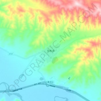
玛查理镇 topographic map
Interactive map
Click on the map to display elevation.
About this map
Name: 玛查理镇 topographic map, elevation, terrain.
Location: 玛查理镇, 玛多县, 果洛藏族自治州, 青海省, 中国 (34.87692 98.17202 34.95692 98.25202)
Average elevation: 4,323 m
Minimum elevation: 4,213 m
Maximum elevation: 4,575 m
Other topographic maps
Click on a map to view its topography, its elevation and its terrain.