
Thank you for supporting this site ❤️
Make a donation
Make a donation
Villano topographic map
Click on the map to display elevation.
Thank you for supporting this site ❤️
Make a donation
Make a donation
About this map
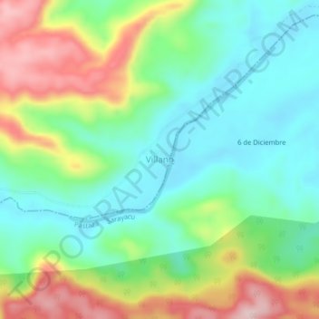
Name: Villano topographic map, elevation, terrain.
Location: Villano, Curaray, Arajuno, Pastaza, Ecuador (-1.52000 -77.50333 -1.48000 -77.46333)
Average elevation: 422 m
Minimum elevation: 330 m
Maximum elevation: 593 m
Thank you for supporting this site ❤️
Make a donation
Make a donation
Other topographic maps
Click on a map to view its topography, its elevation and its terrain.