
Celeirós topographic map
Interactive map
Click on the map to display elevation.
About this map
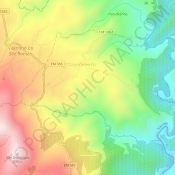
Name: Celeirós topographic map, elevation, terrain.
Location: Celeirós, Sabrosa, Vila Real, 5060-011, Portugal (41.22768 -7.57536 41.24927 -7.53150)
Average elevation: 437 m
Minimum elevation: 139 m
Maximum elevation: 794 m
Other topographic maps
Click on a map to view its topography, its elevation and its terrain.