
Thank you for supporting this site ❤️
Make a donation
Make a donation
Benghazi topographic map
Click on the map to display elevation.
Thank you for supporting this site ❤️
Make a donation
Make a donation
Benghazi
The largest Ottoman architectural monument in Benghazi is the late 19th-century Ottoman palace in El-Berka; built during the rule of Rashid Pasha II. The front elevation was completed in 1895, whilst the side sections were added later during Italian rule. The white and green structure houses 360 rooms; and is on a tract of land where Gamal Abdel Nasser Street meets al-Saqzali Street; south of the 28 March football stadium.
Thank you for supporting this site ❤️
Make a donation
Make a donation
About this map
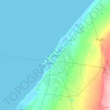
Name: Benghazi topographic map, elevation, terrain.
Location: Benghazi, Libya (31.96883 19.92172 32.28883 20.24172)
Average elevation: 23 m
Minimum elevation: -8 m
Maximum elevation: 148 m
Thank you for supporting this site ❤️
Make a donation
Make a donation
Other topographic maps
Click on a map to view its topography, its elevation and its terrain.