Dobhi topographic map
Interactive map
Click on the map to display elevation.
About this map
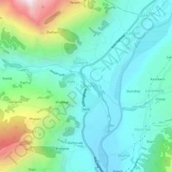
Name: Dobhi topographic map, elevation, terrain.
Location: Dobhi, Kullu, Kullu District, Himachal Pradesh, 175128, India (32.07151 77.10587 32.11151 77.14587)
Average elevation: 1,696 m
Minimum elevation: 1,374 m
Maximum elevation: 2,698 m
Other topographic maps
Click on a map to view its topography, its elevation and its terrain.
Tiun
India > Himachal Pradesh > Kullu
Tiun, Kullu, Kullu District, Himachal Pradesh, India
Average elevation: 2,723 m
Kalga
India > Himachal Pradesh > Kullu > Pulga
Kalga, Pulga, Kullu, Himachal Pradesh, India
Average elevation: 2,622 m
Rudgranag
India > Himachal Pradesh > Kullu
Rudgranag, Kullu, Himachal Pradesh, India
Average elevation: 3,070 m
Brahman Koti
India > Himachal Pradesh > Kullu > Naggar
Brahman Koti, Naggar, Kullu, Himachal Pradesh, 175130, India
Average elevation: 1,774 m
Bhuntar
India > Himachal Pradesh > Kullu
Bhuntar, Kullu, Kullu District, Himachal Pradesh, 175126, India
Average elevation: 1,559 m
Goj
India > Himachal Pradesh > Kullu > Manikaran
Goj, Manikaran, Kullu, Himachal Pradesh, 175105, India
Average elevation: 2,176 m
Shat
India > Himachal Pradesh > Kullu > Shat
Shat, Kullu, Himachal Pradesh, India
Average elevation: 1,729 m
Tosh
India > Himachal Pradesh > Kullu > Tosh
Tosh, Kullu, Himachal Pradesh, India
Average elevation: 2,710 m