
Thank you for supporting this site ❤️
Make a donation
Make a donation
Angamoozhy topographic map
Click on the map to display elevation.
Thank you for supporting this site ❤️
Make a donation
Make a donation
Angamoozhy
Angamoozhy is geographically a high-range area (Malanadu) situated in the south eastern part of Kerala and very close to the Western ghats mountain ranges. It has an average elevation of 18 m (59 ft) above sea level.
Thank you for supporting this site ❤️
Make a donation
Make a donation
About this map
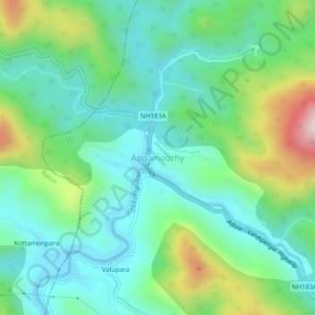
Name: Angamoozhy topographic map, elevation, terrain.
Location: Angamoozhy, Konni, Pathanamthitta, Kerala, India (9.34078 76.96881 9.38078 77.00881)
Average elevation: 233 m
Minimum elevation: 76 m
Maximum elevation: 646 m
Thank you for supporting this site ❤️
Make a donation
Make a donation
Other topographic maps
Click on a map to view its topography, its elevation and its terrain.