
Chifeng City topographic map
Interactive map
Click on the map to display elevation.
About this map
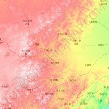
Name: Chifeng City topographic map, elevation, terrain.
Location: Chifeng City, Inner Mongolia, China (41.28028 116.34980 45.24995 120.98080)
Average elevation: 807 m
Minimum elevation: 5 m
Maximum elevation: 2,002 m
Other topographic maps
Click on a map to view its topography, its elevation and its terrain.