
Thank you for supporting this site ❤️
Make a donation
Make a donation
Peterculter topographic map
Click on the map to display elevation.
Thank you for supporting this site ❤️
Make a donation
Make a donation
About this map
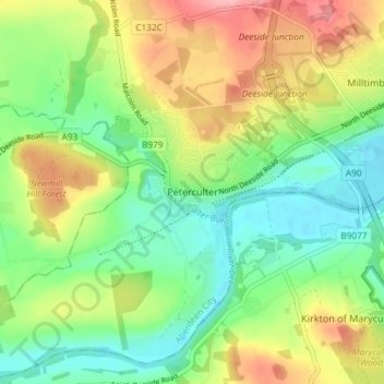
Name: Peterculter topographic map, elevation, terrain.
Location: Peterculter, Aberdeen City, Scotland, AB14 0SG, United Kingdom (57.07611 -2.28745 57.11611 -2.24745)
Average elevation: 61 m
Minimum elevation: 11 m
Maximum elevation: 139 m
Thank you for supporting this site ❤️
Make a donation
Make a donation
Other topographic maps
Click on a map to view its topography, its elevation and its terrain.