
Thank you for supporting this site ❤️
Make a donation
Make a donation
Camas topographic map
Click on the map to display elevation.
Thank you for supporting this site ❤️
Make a donation
Make a donation
About this map
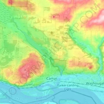
Name: Camas topographic map, elevation, terrain.
Location: Camas, Clark County, Washington, 98607, United States (45.56346 -122.47428 45.65642 -122.36732)
Average elevation: 94 m
Minimum elevation: -2 m
Maximum elevation: 278 m
Thank you for supporting this site ❤️
Make a donation
Make a donation