
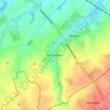
Diets-Heur topographic map
Interactive map
Click on the map to display elevation.
About this map
Name: Diets-Heur topographic map, elevation, terrain.
Location: Diets-Heur, Tongeren, Limburg, Vlaanderen, 4452, België (50.72502 5.46435 50.76502 5.50435)
Average elevation: 117 m
Minimum elevation: 89 m
Maximum elevation: 154 m
Diets-Heur bevindt zich in droog-Haspengouw op een hoogte van 97 tot 137 meter. De enige waterloop is het beekje de Buth, dat in noordoostelijke richting stroomt. Het dorp ligt aan de taalgrens.