
Thank you for supporting this site ❤️
Make a donation
Make a donation
Ko Hang topographic map
Click on the map to display elevation.
Thank you for supporting this site ❤️
Make a donation
Make a donation
About this map
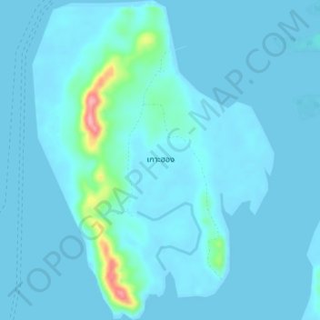
Name: Ko Hang topographic map, elevation, terrain.
Location: Ko Hang, Laem Kruat, Krabi Province, Thailand (7.83592 99.00257 7.88455 99.03972)
Average elevation: 10 m
Minimum elevation: -2 m
Maximum elevation: 130 m
Thank you for supporting this site ❤️
Make a donation
Make a donation