
Merindades topographic map
Interactive map
Click on the map to display elevation.
About this map
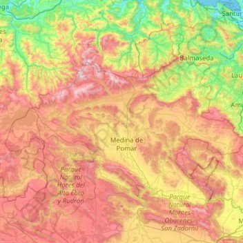
Name: Merindades topographic map, elevation, terrain.
Location: Merindades, Castile and León, Spain (42.80082 -3.99098 43.19875 -2.98106)
Average elevation: 679 m
Minimum elevation: -1 m
Maximum elevation: 1,682 m
Other topographic maps
Click on a map to view its topography, its elevation and its terrain.