
Thank you for supporting this site ❤️
Make a donation
Make a donation
Garrett Dam topographic map
Click on the map to display elevation.
Thank you for supporting this site ❤️
Make a donation
Make a donation
About this map
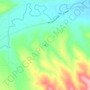
Name: Garrett Dam topographic map, elevation, terrain.
Location: Garrett Dam, Sheridan County, Wyoming, United States (44.76044 -107.05887 44.76096 -107.05838)
Average elevation: 1,239 m
Minimum elevation: 1,182 m
Maximum elevation: 1,350 m
Thank you for supporting this site ❤️
Make a donation
Make a donation
Other topographic maps
Click on a map to view its topography, its elevation and its terrain.