
Thank you for supporting this site ❤️
Make a donation
Make a donation
Gingelom topographic map
Click on the map to display elevation.
Thank you for supporting this site ❤️
Make a donation
Make a donation
About this map
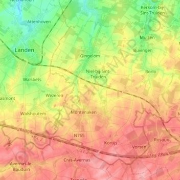
Name: Gingelom topographic map, elevation, terrain.
Location: Gingelom, Hasselt, Limbourg, Flandre, Belgique (50.69543 5.10153 50.77025 5.24394)
Average elevation: 107 m
Minimum elevation: 56 m
Maximum elevation: 147 m
Thank you for supporting this site ❤️
Make a donation
Make a donation
Other topographic maps
Click on a map to view its topography, its elevation and its terrain.