
Kolam Takungan JPS Taman Gadong Jaya topographic map
Interactive map
Click on the map to display elevation.
About this map
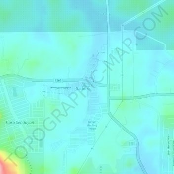
Name: Kolam Takungan JPS Taman Gadong Jaya topographic map, elevation, terrain.
Average elevation: 56 m
Minimum elevation: 35 m
Maximum elevation: 177 m
Other topographic maps
Click on a map to view its topography, its elevation and its terrain.
Tiara Central Park
Malaysia > Negeri Sembilan > Gadong
Tiara Central Park, Tiara Sendayan, Gadong, Seremban, Negeri Sembilan, Malaysia
Average elevation: 70 m