
梅家水库 topographic map
Interactive map
Click on the map to display elevation.
About this map
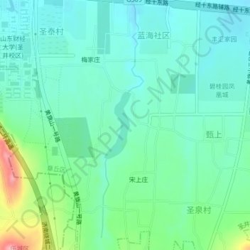
Name: 梅家水库 topographic map, elevation, terrain.
Location: 梅家水库, 宋上庄, 圣井街道, 章丘区, 济南市, 山东省, 中国 (36.65586 117.38075 36.66312 117.38441)
Average elevation: 119 m
Minimum elevation: 89 m
Maximum elevation: 214 m