
加里宁格勒市 topographic map
Interactive map
Click on the map to display elevation.
About this map
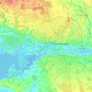
Name: 加里宁格勒市 topographic map, elevation, terrain.
Location: 加里宁格勒市, 加里宁格勒州, 西北联邦管区, 俄罗斯 (54.63062 20.29328 54.77868 20.65380)
Average elevation: 18 m
Minimum elevation: -5 m
Maximum elevation: 58 m
Other topographic maps
Click on a map to view its topography, its elevation and its terrain.