
Thank you for supporting this site ❤️
Make a donation
Make a donation
Hata topographic map
Click on the map to display elevation.
Thank you for supporting this site ❤️
Make a donation
Make a donation
About this map
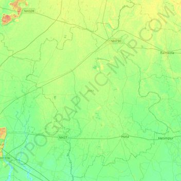
Name: Hata topographic map, elevation, terrain.
Location: Hata, Kushinagar District, Uttar Pradesh, India (26.65938 83.52441 27.00106 83.92387)
Average elevation: 84 m
Minimum elevation: 72 m
Maximum elevation: 103 m
Thank you for supporting this site ❤️
Make a donation
Make a donation