
La Ville Hurien topographic map
Interactive map
Click on the map to display elevation.
About this map
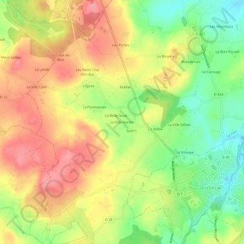
Name: La Ville Hurien topographic map, elevation, terrain.
Average elevation: 209 m
Minimum elevation: 156 m
Maximum elevation: 256 m
Other topographic maps
Click on a map to view its topography, its elevation and its terrain.
22800
France > Bretagne > Côtes-d'Armor > Le Fœil > |a Pommeraie
22800, |a Pommeraie, Le Fœil, Saint-Brieuc, Côtes-d'Armor, Bretagne, France métropolitaine, France
Average elevation: 220 m