
小金彝族乡 topographic map
Interactive map
Click on the map to display elevation.
About this map
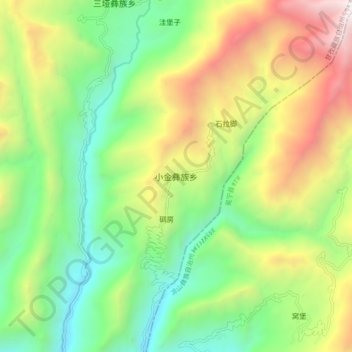
Name: 小金彝族乡 topographic map, elevation, terrain.
Location: 小金彝族乡, 九龙县, 甘孜藏族自治州, 四川省, 中国 (28.62150 101.88465 28.70150 101.96465)
Average elevation: 2,445 m
Minimum elevation: 1,539 m
Maximum elevation: 3,922 m
Other topographic maps
Click on a map to view its topography, its elevation and its terrain.