
Amtmannsdorf topographic map
Interactive map
Click on the map to display elevation.
About this map
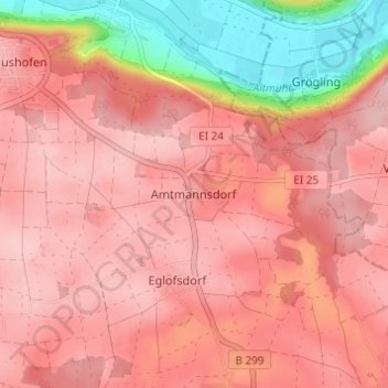
Name: Amtmannsdorf topographic map, elevation, terrain.
Average elevation: 477 m
Minimum elevation: 357 m
Maximum elevation: 523 m
Other topographic maps
Click on a map to view its topography, its elevation and its terrain.
Paulushofen
Deutschland > Bayern > Landkreis Eichstätt > Beilngries > Paulushofen
Paulushofen, Beilngries, Landkreis Eichstätt, Bayern, 92339, Deutschland
Average elevation: 460 m