
Newbiggin topographic map
Click on the map to display elevation.
About this map
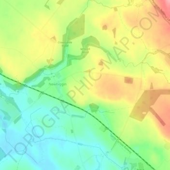
Name: Newbiggin topographic map, elevation, terrain.
Location: Newbiggin, Westmorland and Furness, England, United Kingdom (54.63442 -2.59559 54.66564 -2.54839)
Average elevation: 146 m
Minimum elevation: 99 m
Maximum elevation: 207 m
Other topographic maps
Click on a map to view its topography, its elevation and its terrain.
Berry Island
United Kingdom > England > Westmorland and Furness > Low Wood > High Brow Edge
Average elevation: 68 m