
烏蘭烏德 topographic map
Interactive map
Click on the map to display elevation.
About this map
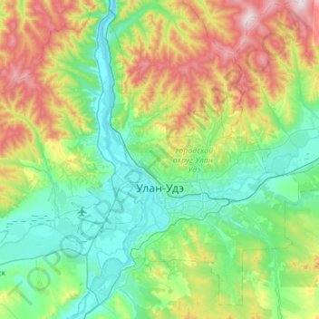
Name: 烏蘭烏德 topographic map, elevation, terrain.
Location: 烏蘭烏德, городской округ Улан-Удэ, 布里亚特共和国, 远东联邦管区, 俄罗斯 (51.71000 107.40824 52.02135 107.95827)
Average elevation: 720 m
Minimum elevation: 485 m
Maximum elevation: 1,369 m