
Village of West Haverstraw topographic map
Interactive map
Click on the map to display elevation.
About this map
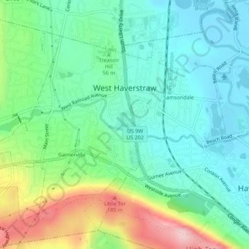
Name: Village of West Haverstraw topographic map, elevation, terrain.
Average elevation: 62 m
Minimum elevation: 0 m
Maximum elevation: 210 m
Other topographic maps
Click on a map to view its topography, its elevation and its terrain.
Thiells
United States > New York > Rockland County > Town of Haverstraw
Thiells, Town of Haverstraw, Rockland County, New York, 10984, United States
Average elevation: 114 m
Village of Pomona
United States > New York > Rockland County > Town of Haverstraw
Village of Pomona, Town of Haverstraw, Rockland County, New York, United States
Average elevation: 186 m
Village of Haverstraw
United States > New York > Rockland County > Town of Haverstraw
Village of Haverstraw, Town of Haverstraw, Rockland County, New York, 10927, United States
Average elevation: 44 m