
General Cepeda topographic map
Interactive map
Click on the map to display elevation.
About this map
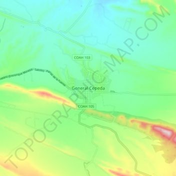
Name: General Cepeda topographic map, elevation, terrain.
Location: General Cepeda, Coahuila, México (25.33909 -101.51611 25.41909 -101.43611)
Average elevation: 1,486 m
Minimum elevation: 1,381 m
Maximum elevation: 1,747 m
Other topographic maps
Click on a map to view its topography, its elevation and its terrain.
San José del Refugio
México > Coahuila > General Cepeda
San José del Refugio, General Cepeda, Coahuila, México
Average elevation: 1,730 m