
坡妹镇 topographic map
Interactive map
Click on the map to display elevation.
About this map
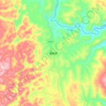
Name: 坡妹镇 topographic map, elevation, terrain.
Location: 坡妹镇, 册亨县, 黔西南布依族苗族自治州, 贵州省, 中国 (25.20990 105.61800 25.28990 105.69800)
Average elevation: 1,059 m
Minimum elevation: 755 m
Maximum elevation: 1,421 m
Other topographic maps
Click on a map to view its topography, its elevation and its terrain.