
Thank you for supporting this site ❤️
Make a donation
Make a donation
Lille-Saint-Hubert topographic map
Click on the map to display elevation.
Thank you for supporting this site ❤️
Make a donation
Make a donation
About this map
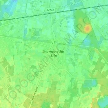
Name: Lille-Saint-Hubert topographic map, elevation, terrain.
Location: Lille-Saint-Hubert, Pelt, Maaseik, Limbourg, Flandre, Belgique (51.20458 5.46278 51.24523 5.52906)
Average elevation: 40 m
Minimum elevation: 30 m
Maximum elevation: 52 m
Thank you for supporting this site ❤️
Make a donation
Make a donation