
Flötz topographic map
Interactive map
Click on the map to display elevation.
About this map
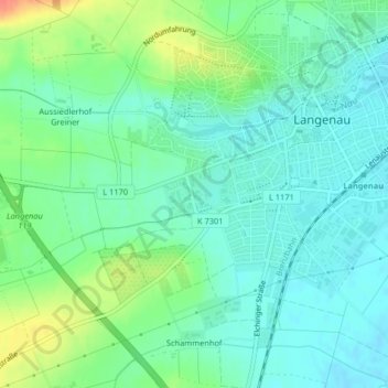
Name: Flötz topographic map, elevation, terrain.
Average elevation: 472 m
Minimum elevation: 457 m
Maximum elevation: 505 m
Other topographic maps
Click on a map to view its topography, its elevation and its terrain.
Osterstetten
Deutschland > Baden-Württemberg > Langenau > Osterstetten
Osterstetten, Langenau, GVV Langenau, Alb-Donau-Kreis, Baden-Württemberg, 89182, Deutschland
Average elevation: 530 m