
Thank you for supporting this site ❤️
Make a donation
Make a donation
Donie topographic map
Click on the map to display elevation.
Thank you for supporting this site ❤️
Make a donation
Make a donation
About this map
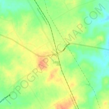
Name: Donie topographic map, elevation, terrain.
Location: Donie, Freestone County, Texas, 75838, United States (31.45712 -96.24247 31.49712 -96.20247)
Average elevation: 143 m
Minimum elevation: 120 m
Maximum elevation: 164 m
Thank you for supporting this site ❤️
Make a donation
Make a donation
Other topographic maps
Click on a map to view its topography, its elevation and its terrain.