
Thank you for supporting this site ❤️
Make a donation
Make a donation
Booval topographic map
Click on the map to display elevation.
Thank you for supporting this site ❤️
Make a donation
Make a donation
About this map
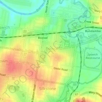
Name: Booval topographic map, elevation, terrain.
Location: Booval, Greater Brisbane, Queensland, Australia (-27.61900 152.78290 -27.60858 152.80141)
Average elevation: 30 m
Minimum elevation: 2 m
Maximum elevation: 58 m
Thank you for supporting this site ❤️
Make a donation
Make a donation
Other topographic maps
Click on a map to view its topography, its elevation and its terrain.