
Karunguzhi topographic map
Interactive map
Click on the map to display elevation.
About this map
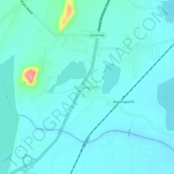
Name: Karunguzhi topographic map, elevation, terrain.
Average elevation: 30 m
Minimum elevation: 17 m
Maximum elevation: 121 m
Other topographic maps
Click on a map to view its topography, its elevation and its terrain.
Vedanthangal
India > Tamil Nadu > Maduranthakam > Vedanthangal
Vedanthangal, Maduranthakam, Chengalpattu District, Tamil Nadu, 603303, India
Average elevation: 41 m