
西洋河 topographic map
Interactive map
Click on the map to display elevation.
About this map
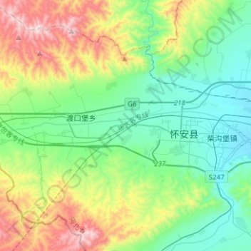
Name: 西洋河 topographic map, elevation, terrain.
Location: 西洋河, 怀安县, 张家口市, 中国 (40.66865 114.19430 40.68992 114.44492)
Average elevation: 1,060 m
Minimum elevation: 773 m
Maximum elevation: 1,769 m