
大沅河水库 topographic map
Interactive map
Click on the map to display elevation.
About this map
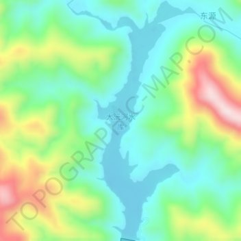
Name: 大沅河水库 topographic map, elevation, terrain.
Location: 大沅河水库, 东源, 枧田街乡, 鄱阳县, 上饶市, 江西省, 中国 (29.49202 117.00042 29.52112 117.01797)
Average elevation: 183 m
Minimum elevation: 66 m
Maximum elevation: 435 m