
朱家坳 topographic map
Interactive map
Click on the map to display elevation.
About this map
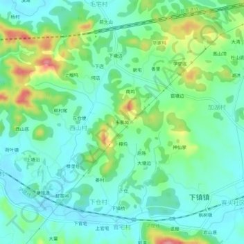
Name: 朱家坳 topographic map, elevation, terrain.
Location: 朱家坳, 西山村, 下镇镇, 玉山县, 上饶市, 江西省, 中国 (28.63515 118.36179 28.67515 118.40179)
Average elevation: 132 m
Minimum elevation: 103 m
Maximum elevation: 206 m