
Thank you for supporting this site ❤️
Make a donation
Make a donation
Big Major Cay topographic map
Click on the map to display elevation.
Thank you for supporting this site ❤️
Make a donation
Make a donation
About this map
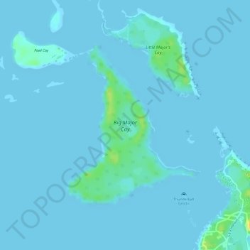
Name: Big Major Cay topographic map, elevation, terrain.
Location: Big Major Cay, Exuma, The Bahamas (24.17753 -76.46078 24.19490 -76.44503)
Average elevation: 2 m
Minimum elevation: -1 m
Maximum elevation: 23 m
Thank you for supporting this site ❤️
Make a donation
Make a donation