
Thank you for supporting this site ❤️
Make a donation
Make a donation
Mekarsari topographic map
Click on the map to display elevation.
Thank you for supporting this site ❤️
Make a donation
Make a donation
About this map
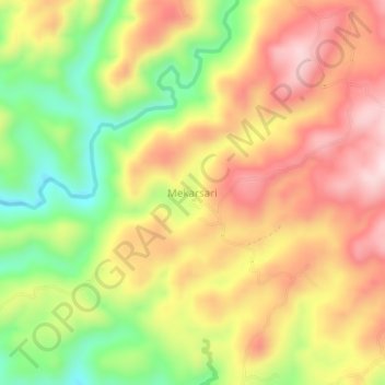
Name: Mekarsari topographic map, elevation, terrain.
Location: Mekarsari, Lebak, Banten, Indonesia (-6.84711 106.14773 -6.80711 106.18773)
Average elevation: 284 m
Minimum elevation: 99 m
Maximum elevation: 441 m
Thank you for supporting this site ❤️
Make a donation
Make a donation