
Melloul topographic map
Interactive map
Click on the map to display elevation.
About this map
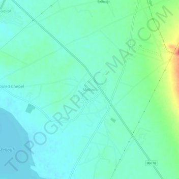
Name: Melloul topographic map, elevation, terrain.
Location: Melloul, Daïra Aïn Oulmane, Sétif, 19050, RADP (35.99634 5.34237 36.03634 5.38237)
Average elevation: 913 m
Minimum elevation: 898 m
Maximum elevation: 960 m