Geolocate

杨镇 topographic map

Interactive map

Click on the map to display elevation.

About this map

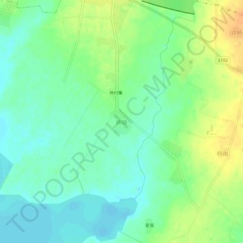
Name: 杨镇 topographic map, elevation, terrain.

Location: 杨镇, 淮南市, 安徽省, 中国 (32.51022 116.89646 32.55022 116.93646)

Average elevation: 28 m

Minimum elevation: 15 m

Maximum elevation: 48 m

Other topographic maps

Click on a map to view its topography, its elevation and its terrain.

魏岗

中国 > 安徽省 > 淮南市

魏岗, 淮南市, 安徽省, 中国

Average elevation: 28 m

黑龙

中国 > 安徽省 > 淮南市

黑龙, 淮南市, 安徽省, 中国

Average elevation: 22 m

菱角

中国 > 安徽省 > 淮南市

菱角, 淮南市, 安徽省, 中国

Average elevation: 22 m

毛集镇

中国 > 安徽省 > 淮南市

毛集镇, 淮南市, 安徽省, 中国

Average elevation: 22 m

杨村镇

中国 > 安徽省 > 淮南市

杨村镇, 淮南市, 安徽省, 中国

Average elevation: 25 m

孤堆乡

中国 > 安徽省 > 淮南市

孤堆乡, 淮南市, 安徽省, 中国

Average elevation: 35 m