
Ansart topographic map
Interactive map
Click on the map to display elevation.
About this map
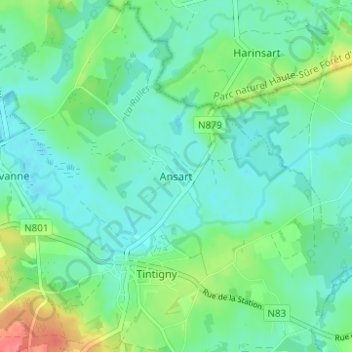
Name: Ansart topographic map, elevation, terrain.
Location: Ansart, Tintigny, Virton, Luxembourg, Wallonie, 6730, Belgique (49.67316 5.50192 49.71316 5.54192)
Average elevation: 339 m
Minimum elevation: 322 m
Maximum elevation: 389 m