
Écoivres topographic map
Interactive map
Click on the map to display elevation.
About this map
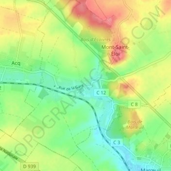
Name: Écoivres topographic map, elevation, terrain.
Average elevation: 99 m
Minimum elevation: 67 m
Maximum elevation: 141 m
Other topographic maps
Click on a map to view its topography, its elevation and its terrain.
Bray
France > Hauts-de-France > Pas-de-Calais > Mont-Saint-Éloi
Bray, Mont-Saint-Éloi, Arras, Pas-de-Calais, Hauts-de-France, France métropolitaine, 62144, France
Average elevation: 94 m