
Tegau topographic map
Interactive map
Click on the map to display elevation.
About this map
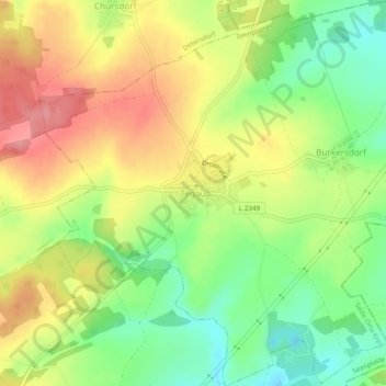
Name: Tegau topographic map, elevation, terrain.
Location: Tegau, Seenplatte, Saale-Orla-Kreis, Thüringen, Deutschland (50.63340 11.84307 50.66400 11.89066)
Average elevation: 444 m
Minimum elevation: 394 m
Maximum elevation: 497 m