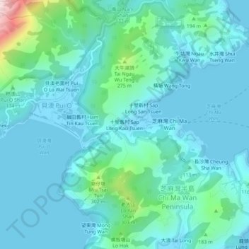
Sap Long Kau Tsuen topographic map
Interactive map
Click on the map to display elevation.
About this map
Name: Sap Long Kau Tsuen topographic map, elevation, terrain.
Average elevation: 84 m
Minimum elevation: -10 m
Maximum elevation: 582 m

Click on the map to display elevation.
Name: Sap Long Kau Tsuen topographic map, elevation, terrain.
Average elevation: 84 m
Minimum elevation: -10 m
Maximum elevation: 582 m