
华容县 topographic map
Interactive map
Click on the map to display elevation.
About this map
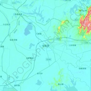
Name: 华容县 topographic map, elevation, terrain.
Location: 华容县, 岳阳市, 湖南省, 中国 (29.37093 112.37620 29.69093 112.69620)
Average elevation: 39 m
Minimum elevation: 20 m
Maximum elevation: 347 m
辖境地处洞庭湖凹陷背缘,地势北高南低,中部丘岗隆起,东西低平开阔,微向东洞庭湖倾斜。地貌分区特征明显,北部为低山丘陵区,间有溪谷平原,中南部为丘岗区,其余为平原;全境山地总面积328.2平方公里,占17.8%,平原1028.66平方公里,占56%。境内海拔最高点为雷打岩,位于东山镇境内。
Other topographic maps
Click on a map to view its topography, its elevation and its terrain.