
Aïn Deheb topographic map
Interactive map
Click on the map to display elevation.
About this map
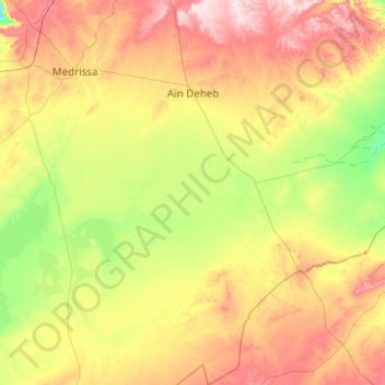
Name: Aïn Deheb topographic map, elevation, terrain.
Location: Aïn Deheb, daïra Aïn Deheb, Tiaret, Algérie (34.22523 1.34594 35.04253 1.80382)
Average elevation: 1,085 m
Minimum elevation: 920 m
Maximum elevation: 1,381 m
Other topographic maps
Click on a map to view its topography, its elevation and its terrain.
Chehaima
Algérie > Tiaret > daïra Aïn Deheb
Chehaima, daïra Aïn Deheb, Tiaret, Algérie
Average elevation: 1,083 m