
梵净山 topographic map
Interactive map
Click on the map to display elevation.
About this map
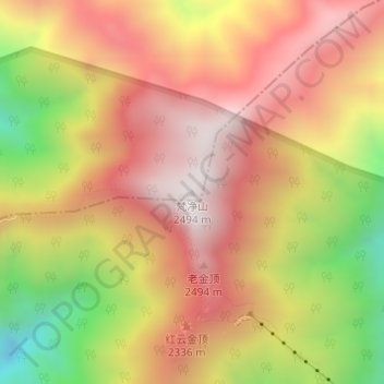
Name: 梵净山 topographic map, elevation, terrain.
Location: 梵净山, 印江土家族苗族自治县, 贵州省, 中国 (27.91934 108.69209 27.91944 108.69219)
Average elevation: 2,054 m
Minimum elevation: 1,466 m
Maximum elevation: 2,459 m
梵净山位于中国贵州铜仁市的印江县、江口县、松桃县交界处,为武陵山脉主峰,其主峰為鳳凰山海拔高2,572米。原始生态保存完好,1982年被联合国列为一级世界生态保护区。2018年7月2日,在巴林麦纳麦举行的世界遗产大会上被列入世界自然遗产名录。梵净山拥有丰富的野生动植物资源,比如黔金丝猴、珙桐等珍稀物种。
Other topographic maps
Click on a map to view its topography, its elevation and its terrain.