
Belagavi topographic map
Interactive map
Click on the map to display elevation.
Belagavi
Belgaum is located at 15°52′N 74°30′E / 15.87°N 74.5°E / 15.87; 74.5. It has an average elevation of 751 metres (2,464 feet). The city is in the northwestern parts of Karnataka and lies at the border of two states, Maharashtra and Goa on the western ghats (50 km from the Goa state border). It is one of the oldest towns in the state, lying 502 km from Bangalore, 515 km from Hyderabad , 500 km from Mumbai . The district comprises 1278 villages with an area of 13,415 km² and a population of around 4.8 million according to the census of 2011. Belgaum district is the biggest district of Karnataka. Situated near the foothills of the Sahyadri mountain range (Western Ghats) at an altitude of about 779 m, 100 km from the Arabian Sea with the Markandeya river flowing nearby, Belgaum exhibits swift and kaleidoscopic changes in topography, vegetation and climate.
About this map
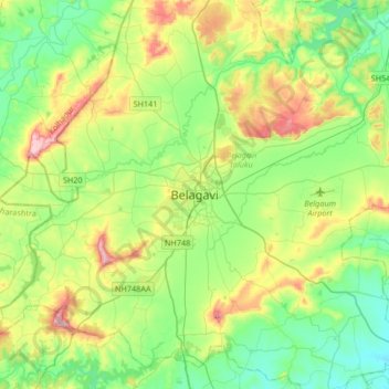
Name: Belagavi topographic map, elevation, terrain.
Average elevation: 760 m
Minimum elevation: 644 m
Maximum elevation: 1,018 m