
Serra d'El-Rei topographic map
Interactive map
Click on the map to display elevation.
About this map
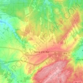
Name: Serra d'El-Rei topographic map, elevation, terrain.
Location: Serra d'El-Rei, Peniche, Leiria, Oeste, Centro, Portugal (39.31102 -9.28898 39.36828 -9.25643)
Average elevation: 89 m
Minimum elevation: 14 m
Maximum elevation: 162 m