
范坝镇 topographic map
Interactive map
Click on the map to display elevation.
About this map
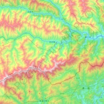
Name: 范坝镇 topographic map, elevation, terrain.
Location: 范坝镇, 文县, 陇南市, 甘肃省, 中国 (32.60522 104.82339 32.79792 105.21606)
Average elevation: 1,384 m
Minimum elevation: 601 m
Maximum elevation: 2,748 m
Other topographic maps
Click on a map to view its topography, its elevation and its terrain.