
Aïn Nechma topographic map
Interactive map
Click on the map to display elevation.
About this map
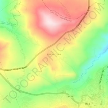
Name: Aïn Nechma topographic map, elevation, terrain.
Location: Aïn Nechma, Daïra Mila, Mila, 43000, Algérie (36.45034 6.22701 36.49034 6.26701)
Average elevation: 464 m
Minimum elevation: 269 m
Maximum elevation: 652 m
Other topographic maps
Click on a map to view its topography, its elevation and its terrain.
Sidi Khelifa
Algérie > Mila > Daïra Mila
Sidi Khelifa, Daïra Mila, Mila, Algérie
Average elevation: 852 m