
Annel topographic map
Interactive map
Click on the map to display elevation.
About this map
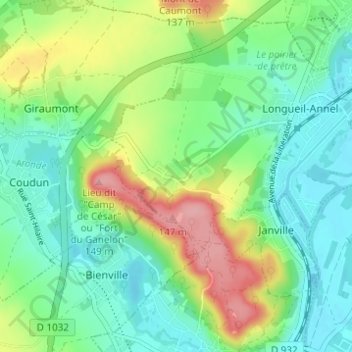
Name: Annel topographic map, elevation, terrain.
Average elevation: 68 m
Minimum elevation: 30 m
Maximum elevation: 146 m
Other topographic maps
Click on a map to view its topography, its elevation and its terrain.
Mare du Mont Ganelon
France > Hauts-de-France > Oise > Longueil-Annel > Annel
Mare du Mont Ganelon, Annel, Longueil-Annel, Compiègne, Oise, Hauts-de-France, France métropolitaine, 60150, France
Average elevation: 76 m